
Introduction
Land surveying and topographic mapping form the foundation of every construction and infrastructure project. Traditionally, these processes relied on 2D drawings and isolated datasets, which often led to misinterpretation or inaccuracies. Today, Building Information Modeling (BIM) is reshaping how survey data is captured, processed, and visualized, enabling surveyors, architects, and engineers to work with precise, data-rich 3D models.
1. Smart Integration of Survey Data into BIM Models
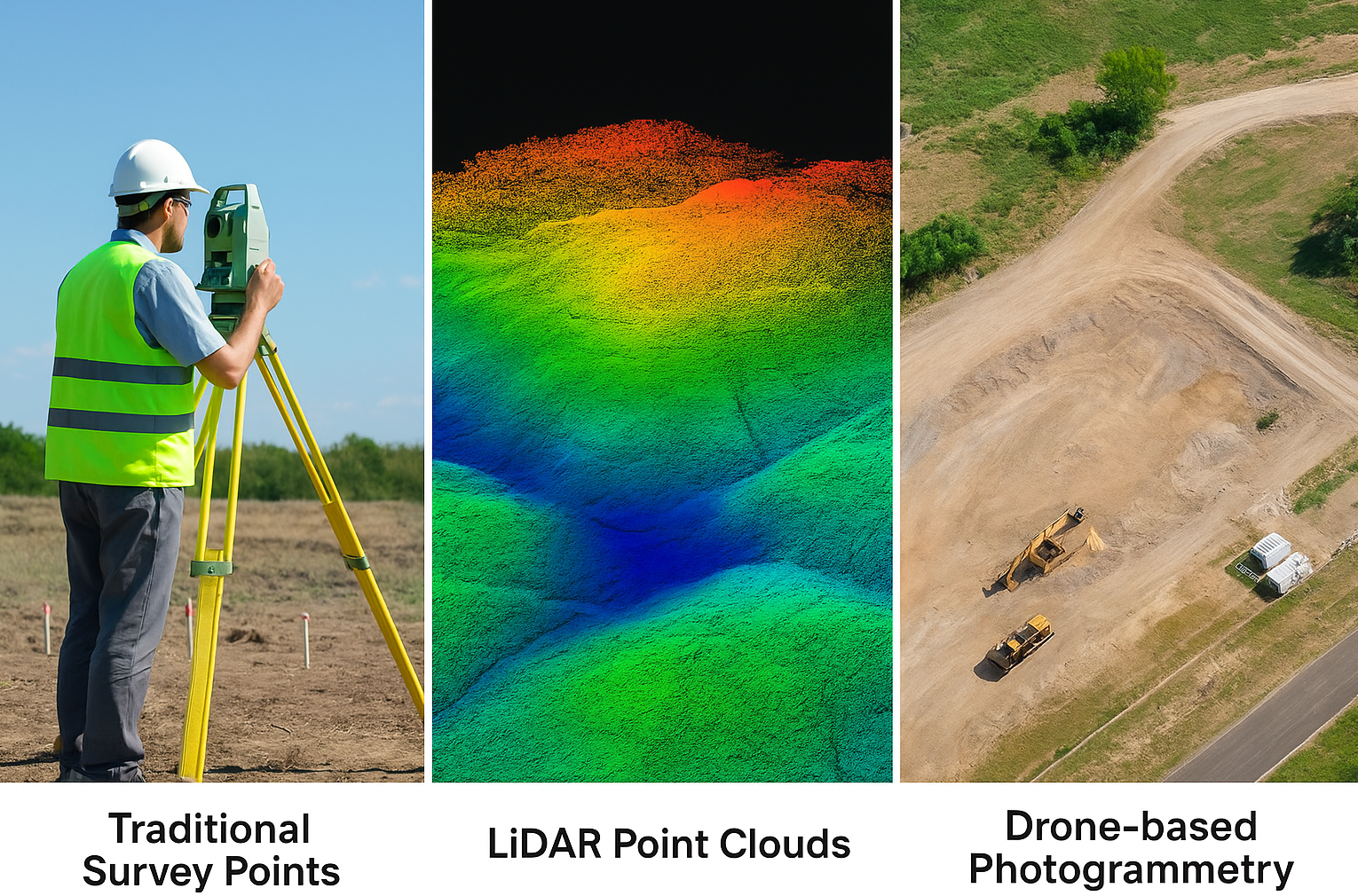
One of BIM’s key strengths in land surveying is its ability to combine multiple data sources — including traditional survey points, LiDAR point clouds, and drone-based photogrammetry — into a single, georeferenced 3D model.
This powerful integration bridges the gap between raw data and intelligent visualization, providing surveyors and engineers with a holistic view of the terrain and built environment.
This fusion enables:
1. High-precision terrain modelling, capturing fine details of the site and existing infrastructure
By merging LiDAR scans, aerial imagery, and traditional ground surveys, BIM creates an accurate digital terrain model (DTM) that captures even the most intricate site details — from minor elevation changes to hidden underground structures.
This precision ensures that planners and designers base their decisions on real-world topography, reducing the margin of error and improving the accuracy of downstream design and construction processes.

2. Early risk identification
With a unified 3D environment, teams can analyze existing site conditions and predict potential risks before construction begins.
BIM allows the detection of:
- Unstable ground zones prone to erosion or settlement
- Utility conflicts between underground or overhead services
- Access or clearance issues impacting construction logistics
- This proactive analysis prevents costly redesigns and delays during later project stages.
3. Improved construction workflow and anticipation
BIM’s realistic 3D visualization empowers teams to simulate site operations — such as material movement, equipment positioning, or cut-and-fill balancing.
By understanding how terrain and infrastructure interact, project managers can optimize logistics, enhance on-site safety, and anticipate potential bottlenecks long before mobilization.
This leads to smoother execution, fewer disruptions, and a more predictable construction timeline.
4. From Raw Data to Actionable Insight
BIM transforms disparate survey datasets into intelligent digital twins — models that not only represent the terrain visually but also embed data attributes like elevation, slope, and material properties.
With these smart models, project teams gain data-driven insight, improving coordination among architects, engineers, and contractors.
The outcome is fewer surprises, reduced rework, and significant cost savings across the project lifecycle.

2. Enhanced Accuracy and Consistency
With BIM, survey data is not only visual but also parametric. Each element carries real-world properties such as coordinates, materials, and dimensions. This level of precision eliminates inconsistencies common in 2D workflows, ensuring all project stakeholders work with the same verified information.
3. Streamlined Collaboration and Data Sharing
BIM provides a centralized digital environment for surveyors, engineers, and planners to collaborate seamlessly. Updates made to the model automatically reflect across all disciplines, reducing data duplication and miscommunication. This collaborative approach enhances decision-making and efficiency, particularly in complex projects.
4. Visualizing Terrain Challenges Before Construction
Through 3D visualization, BIM provides an in-depth understanding of site gradients, slopes, and drainage patterns. Teams can identify potential challenges early — such as uneven terrain, cut-and-fill requirements, or utility conflicts — before construction begins. This proactive approach minimizes rework, delays, and cost overruns.

5. Linking Survey Data to Lifecycle Management
Beyond initial mapping, BIM data supports the entire asset lifecycle. The same model used for design and construction can serve facility management and maintenance teams, keeping accurate terrain and site data accessible for future expansions or repairs.
Conclusion
BIM brings unprecedented accuracy, efficiency, and collaboration to land surveying and topography mapping. By transforming raw survey data into intelligent, coordinated models, it empowers teams to plan smarter, reduce errors, and deliver projects that reflect real-world conditions.
As digital construction advances, BIM-enabled surveying is becoming the new standard for precision in the built environment.