In this blog, we explore how Scan to BIM works for infrastructure projects and the benefits it brings to engineers, contractors, and asset owners.
What is Scan to BIM?
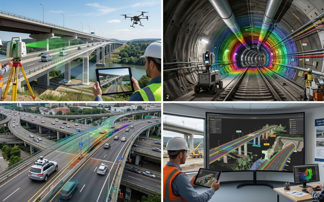
Scan to BIM is a process where laser scanning technology captures the physical environment and converts it into a Building Information Model (BIM). The scanning equipment collects millions of spatial data points, known as point clouds, which represent the geometry of the structure. These point clouds are then processed and modeled to create accurate 3D BIM models. For infrastructure projects such as bridges, tunnels, and roads, Scan to BIM enables engineers to capture detailed structural and geometric information with high precision.
Why Infrastructure Projects Need Scan to BIM
Infrastructure projects often involve complex structures and large-scale environments. Traditional survey methods may not capture enough detail or may require extensive manual work. Scan to BIM provides several advantages:
- Accurate As-Built Documentation
Many existing infrastructure assets lack reliable as-built drawings. Laser scanning captures the exact geometry of structures, providing accurate digital documentation. - Faster Data Collection
Laser scanning can capture large areas quickly compared to traditional surveying methods. This reduces the time required for field data collection. - Improved Planning and Design
Engineers can use BIM models to analyze existing conditions and plan modifications or expansions with confidence. - Reduced Errors and Rework
With precise digital models, design conflicts and inaccuracies can be detected early, minimizing costly rework during construction.
Point Cloud + BIM (Scan-to-BIM) helps infrastructure projects
Point Cloud + BIM (Scan-to-BIM) helps infrastructure projects by capturing highly accurate real-world site conditions and converting them into intelligent 3D models, enabling engineers to design on actual data, detect clashes with existing structures, generate precise quantities and cost estimates, reduce rework and delays, and support efficient construction and long-term asset management.
Applications of Scan to BIM in Infrastructure
1. Bridges
![]()
Bridges require regular inspection and maintenance to ensure structural safety. Scan to BIM helps engineers create accurate 3D models of bridge components such as beams, piers, decks, and railings.
Key benefits include:
- Detailed structural analysis
- Monitoring deformation or damage over time
- Supporting renovation or strengthening projects
- Creating digital twins for bridge asset management
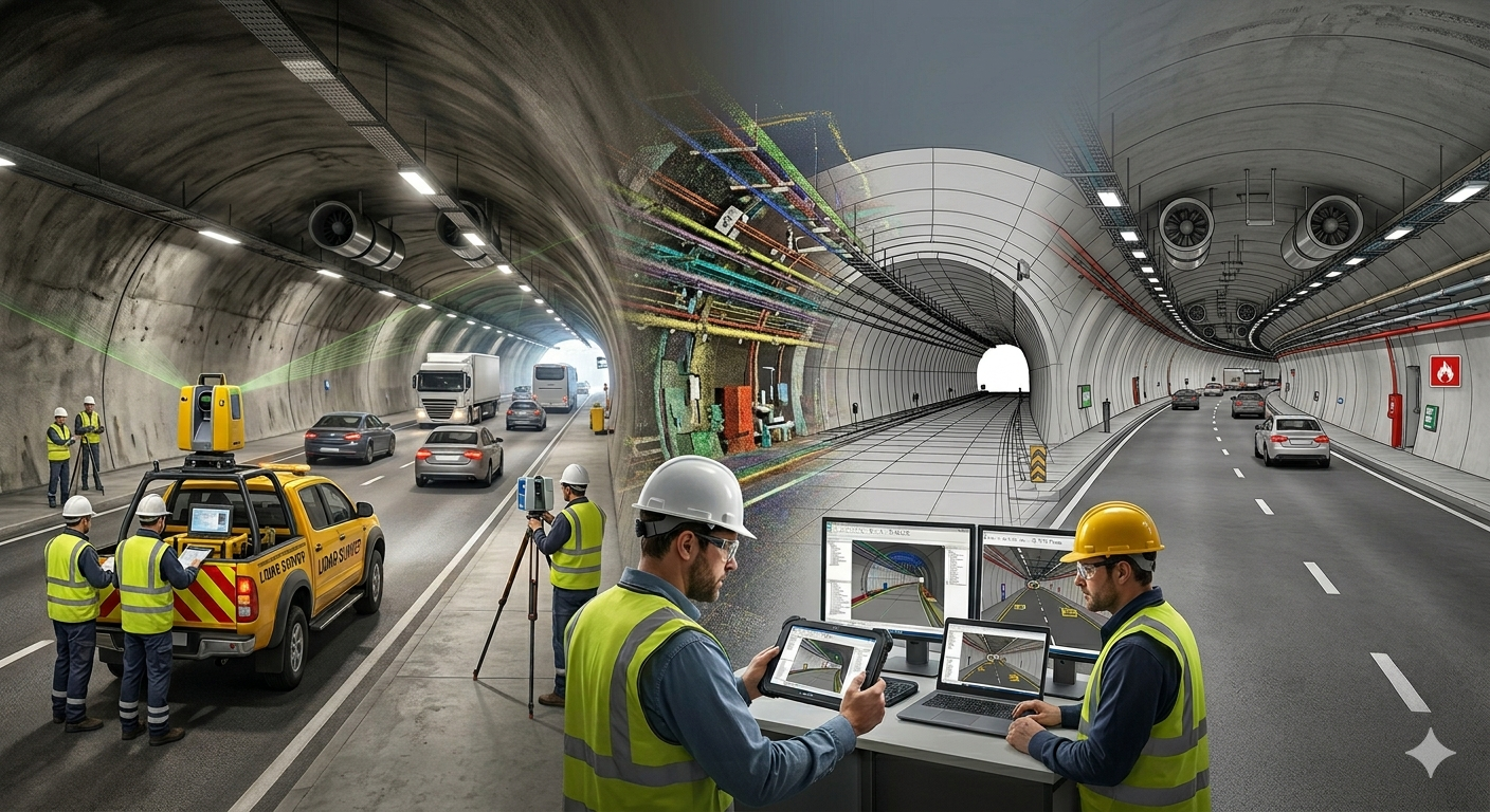
2. Tunnels
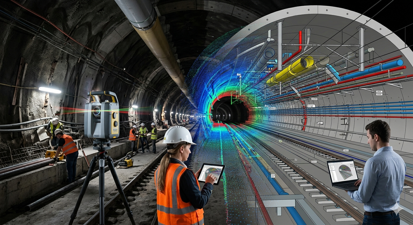
Tunnels present unique challenges due to their confined environments and complex geometries. Laser scanning is particularly useful in capturing tunnel profiles and structural elements.
Scan to BIM for tunnels helps in:
- Capturing precise tunnel geometry
- Monitoring structural changes or deformation
- Supporting tunnel expansion or rehabilitation projects
- Improving safety during maintenance planning
3. Roads and Highways
Road infrastructure often involves large geographic areas and complex intersections. Scan to BIM can capture road corridors, slopes, drainage systems, and surrounding features.
Benefits include:
- Accurate road alignment and surface modeling
- Better planning for road widening or upgrades
- Integration with GIS and infrastructure management systems
- Improved coordination between design and construction teams
Typical Scan to BIM Workflow for Infrastructure
The Scan to BIM process for infrastructure projects typically involves the following steps:
- Laser Scanning and Data Capture
High-precision laser scanners capture millions of data points from the project site. - Point Cloud Processing
The collected scan data is cleaned, registered, and aligned to create a complete point cloud dataset. - BIM Modeling
Engineers and BIM specialists convert the point cloud data into intelligent 3D models with structural elements and metadata. - Quality Control and Validation
The BIM model is checked for accuracy and aligned with project requirements and standards. - Integration with Design and Asset Management
The final BIM model can be used for planning, design coordination, maintenance planning, and digital twin applications.
Key Technologies Used in Infrastructure Scan to BIM
Modern infrastructure Scan to BIM projects use a combination of advanced technologies, including:
- Terrestrial laser scanners
- Mobile mapping systems
- Drone-based photogrammetry
- Point cloud processing software
- BIM modeling platforms
These technologies enable highly detailed and accurate digital representations of complex infrastructure assets.
Challenges in Infrastructure Scan to BIM
Despite its advantages, Scan to BIM projects may face certain challenges:
- Large data volumes requiring powerful processing systems
- Complex geometries in tunnels and bridges
- Access limitations in busy transportation environments
- Need for skilled BIM specialists to convert scan data into usable models
However, with proper planning and expertise, these challenges can be effectively managed.
The Future of Scan to BIM in Infrastructure
As governments and infrastructure owners move toward digital asset management and smart infrastructure, Scan to BIM is becoming an essential technology. Digital twins of bridges, tunnels, and road networks will enable continuous monitoring, predictive maintenance, and improved lifecycle management.The integration of BIM, IoT sensors, and AI-driven analytics will further enhance the value of Scan to BIM in infrastructure projects.
Conclusion
Scan to BIM is transforming how infrastructure projects are documented, analyzed, and managed. By converting real-world structures into accurate digital models, engineers can make better decisions, reduce project risks, and improve long-term asset management. For bridges, tunnels, and road networks, Scan to BIM provides the precise data and digital foundation required for efficient infrastructure development and maintenance in the modern era.
0 Comments